Carlo Lange · 26 September 2026
How River Channel Shifts Over Centuries Have Influenced Farming Practices in Valley Communities
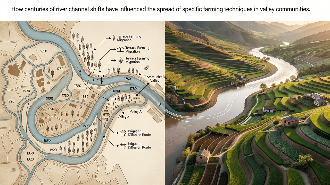
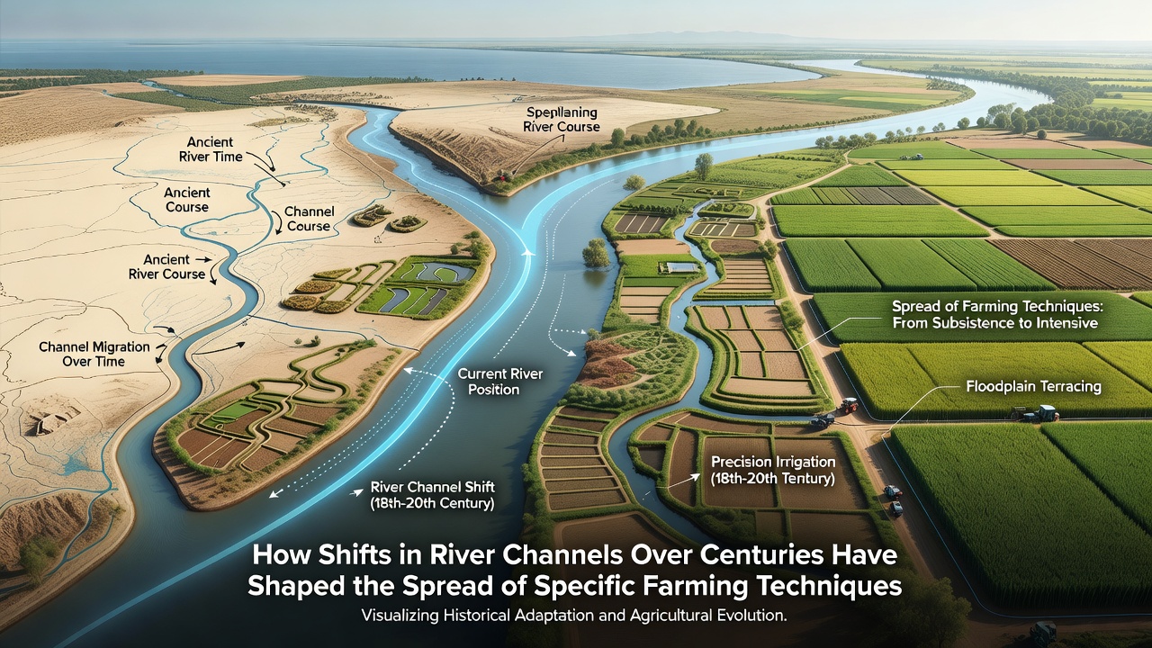
River channels have migrated across valley floors for thousands of years through processes of avulsion, meander cutoff, and gradual bank erosion, and these movements have repeatedly altered the location of fertile floodplains that support agriculture. Communities in river valleys adapted specific cultivation methods to the new sediment patterns and water access that resulted from each shift. Data from geological surveys show that the Mississippi River has changed course more than once every few centuries in its lower reaches, forcing farmers to relocate fields and modify irrigation systems each time the main channel moved.
Historical records from the Nile Valley document how the river's distributaries shifted eastward and westward between 3000 BCE and 1000 CE, and local populations responded by developing basin irrigation techniques that could be rebuilt along the newest active branches. Similar patterns appear in the Yellow River basin where major avulsions between 1048 and 1855 redirected sediment deposits and prompted the spread of raised-field systems that protected crops from sudden flooding on newly formed plains.
Channel Migration and Soil Redistribution
When a river abandons one course and occupies another, the abandoned floodplain gradually loses annual silt replenishment while the new channel deposits fresh layers of sediment in different locations. Researchers at institutions in North America and Europe have mapped these changes using sediment cores and historical maps, revealing that crop yields often declined in areas cut off from regular flooding until farmers introduced new soil management practices. In the Rhine valley, medieval communities shifted from simple flood-recession planting to more intensive manuring and crop rotation after the river's main stem moved several kilometers during the 14th century.
Studies of the Mekong delta indicate that repeated channel switching between the 15th and 19th centuries created patches of higher ground surrounded by seasonal wetlands, and farmers there developed floating rice varieties that could adjust to the altered hydrology. These techniques later spread to neighboring valleys where similar channel dynamics occurred.
Adaptation of Irrigation and Terracing Methods
Valley residents often constructed canals and diversion structures that followed the newest river alignment, yet older channels sometimes remained useful as drainage ditches or secondary water sources. In the Indus valley, archaeological evidence shows that Harappan-era settlements adjusted their grid of irrigation channels multiple times as the river's course migrated westward, and the same pattern of incremental redesign appears in later Mughal and British colonial records.
Terracing systems in Andean valleys provide another example where channel shifts prompted the expansion or abandonment of specific bench levels, with communities extending stone walls to capture new sediment zones while allowing older terraces to revert to pasture. Data collected by the U.S. Geological Survey on the Sacramento River show that 19th-century gold mining accelerated channel incision, which in turn required valley farmers to install pumps and levees that had not been necessary under the previous natural regime.
Regional Spread of Techniques
Techniques developed in one valley frequently traveled to others when migrants carried knowledge of adapted methods to new locations experiencing comparable channel changes. Observers note that raised-bed agriculture first refined along the shifting courses of the Mississippi later appeared in the Missouri valley after similar avulsions occurred there. In Australia, early colonial farmers along the Murray River adopted flood-based sowing calendars originally developed in the Nile and Indus systems after they observed how local channel movements mirrored those older river histories.
European agricultural manuals from the 1700s describe the transfer of contour plowing methods between the Danube and Po valleys as engineers documented how each river's meander migrations created comparable slope conditions. Government agencies in Canada have recorded similar knowledge exchange among First Nations groups along the Fraser and Saskatchewan rivers where channel shifts repeatedly altered prime growing areas.
Contemporary Observations and Ongoing Research
Modern remote-sensing programs continue to track active channel migration in major agricultural valleys, and these data help explain why certain irrigation upgrades appear in specific locations. A 2024 report from the European Environment Agency examined the Po and Guadalquivir basins and found that recent minor avulsions have prompted renewed interest in traditional diversion weirs that had fallen out of use during periods of channel stability.
Researchers tracking the Ganges-Brahmaputra system note that ongoing sediment redistribution continues to influence the placement of deep-water rice paddies, a practice that has persisted through multiple documented channel changes since the 16th century. These findings align with earlier patterns observed in North American and Asian river systems.
Conclusion
Shifts in river channels have consistently required valley communities to adjust the location, design, and timing of their farming operations, and the resulting techniques have often spread between regions facing analogous hydrological conditions. Geological records, archaeological evidence, and contemporary monitoring together demonstrate that these adaptations represent practical responses to changing sediment and water availability rather than isolated innovations. Continued observation of active river systems will likely reveal further refinements in cultivation methods as channels continue their long-term movement across valley landscapes.